Text & Photos: Daniel-C
Hong Kong is a densely populated city, but out of its limited land resources, about three-quarters is countryside.The city's diverse landscape and landforms, with mountain trails expanding like spider webs, offers a unique trail-running experience. It has been favored by international cross-country race organizers for more than 20 years. The first Action Asia Challenge event in Hong Kong in 1998 had stirred up quite a spree of trail running, and began to attract runners from all over the world. In 2015, there were as many as 39 races within a period of six months, and Hong Kong became the "City of Trail Running".
In Hong Kong, the popularity of long-distance trail running actually can be traced back to Oxfam's "Trailwalker" fundraising campaign. Since the enactment of the Country Parks Ordinance in 1976, 21 country parks were established, and the first long-distance hiking trail, the MacLehose Trail, which runs through several country parks, was opened 3 years later. This 100-kilometre trail is regarded as the starting point of trail running in Hong Kong. In 1981, the Queens Gurkha Signals in Hong Kong started hiking the entire MacLehose Trail as a military training exercise, and laid the foundation for future Trailwalker events. Inspired by the unprecedented success of Trailwalker in Hong Kong, Oxfams around the world started to organize their own Trailwalker events, and various large-scale local long-distance cross-country races appeared one after another since then. With the opening of Landau Trail (1984), Hong Kong Trail (1985) and Wilson Trail (1996), more and more cross-country events were staged.
As a sport that combines physical and technical challenges with the enjoyment of natural beauty, long-distance trail running has a charm of its own. I love mountaineering and hiking, but I have never been a fan of long-distance cross-country running. I believe nature should be enjoyed and explored at a slow pace. Walking too fast usually means missing a lot. But of course, there is a time to walk fast, and there is a time to walk long distances. For me, taking walks from 20 to 100km, local or overseas, are not uncommon, but only for two reasons. While trekking in mountainous areas which are sparsely populated, it is common to walk 10 to 20 km from one accommodation point to another. I did participate in some of the cross-country events mentioned earlier, but mainly for fundraising, walking non-stop through day and night for those in need.
Generally speaking, a suitable one-day itinerary is 10 to 15km. Any walking distance exceeding 25km (more than a half-marathon already), especially on a mountain trail, is laborious enough to be regarded as a long-distance route. Even if it is just a day trip, 30km would be the limit. By picking sections from the four major hiking trails, it is easy to plan a 25 to 30-km-long route in Hong Kong. But if you like to have something different, you might as well pick some themes, have target locations in mind, and then see how to link them up with existing trails.
When picking a theme for your countryside trip, natural scenery is the most obvious choice, but heritage themes are also popular. I have once set foot on the "Nakasendo'' in Japan, the 540km ancient post road from Edo (now Tokyo) to Kyoto which passes through 69 post towns along the way. The section I walked, called "Kiso way", is located in the forested valley of the ancient Shinano country, from Narai-juku to Magome-juku. The "Raknus Selu (Camphor Trail)" is another good example, a trail running from Taoyuan Longtan to Taitung Dongshi, advocated by Taiwan Thousand Miles Trail Association in recent years, by linking up ancient trails, agricultural roads, hunting trails and suburban paths along Highway Number 3, emphasising on the cultural scenery of Hakka settlements along the way, remains of a once thriving camphor production industry. There is no lack of ancient trails in Hong Kong. Unfortunately, only fragments were left due to urban development.
Looking for themed hiking trails with natural scenery? There are various official Nature Trails and Tree Walks, ranging from 10km to 600km in length, plus newcomers in recent years such as the High Island Geo Trail. In addition, quite a number of classic long-distance routes had been established by veteran hiking groups in the past : Five Headland of the Northeast, The Four Reservoirs, Four Poles of Hong Kong, One Peak, Three Heads and Four Bays, The Three Teeth, etc. Being a waterfall maniac and devoted stream trekker, I remember well the Millennium Five Dragons stream trekking event held at Tung Chung 22 years ago. Unlike cross-country running, the risk level is higher during stream trekking, and certainly it is more demanding both technically and physically. However, it is not difficult to recommend a 25 to 30-km one-day hiking route, streams and waterfalls themed.
The late Mr. Li Chuin-i once said that Hong Kong has "Four wonders of the wild", and "Streams of Tai Mo Shan" is one of them. The recommended 27-km route will take you through Tai Mo Shan and the adjacent ravines, and can be roughly divided into three sections based on the hydrographic basins. Part of the route was originally for stream trekking, but was modified to hiking along the valley and mountain trails, so that one can still enjoy the beautiful waterfalls and streams from a safe distance during the rainy season. There are many retreat routes on the way, which are also taken into consideration.
(1) From Sheung Shing to Dragon Spring
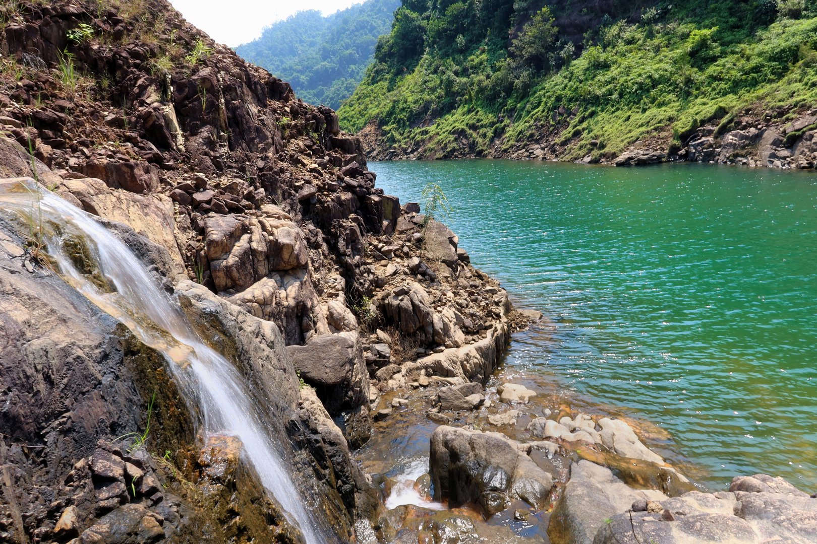
Waterfall below the “Waterpipe Path” along the east shore of Lower Shing Mun
The route starts from the Tai Wai Railway Station and turns to Lower Shing Mun Road through Chik Wan Street. When approaching the Po Fook Memorial Hall, waterfalls of several streams can clearly be seen flowing down the southern slope of Needle Hill. Turn right to the small path and climb the dam of the Lower Shing Mun Reservoir through the grassy slope. There are roads on both ends of the dam leading to the gorge on the north shore. On the left is a trail formerly known as "The Lost City of Iron Chains". This used to be a dangerous path with iron chains installed for climbing, now the rather safe Shatin Country Trail after cement steps has been added. I take the driveway on the right, for a better view of the waterfalls pouring into the reservoir from the Smuggler's Pass streams on the northern slope of Golden Hill. In the middle of the driveway, turn left to the overgrown "Waterpipe Path" along the east shore for a closer view of the reservoir. You can choose to stay on the driveway during bad weather conditions.
Waterfalls at the west shore of Lower Shing Mun – Smuggler’s Pass Stream
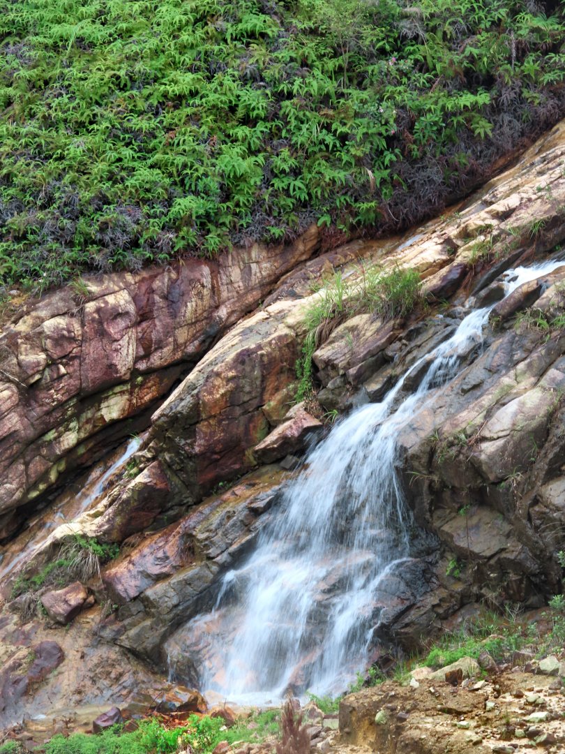
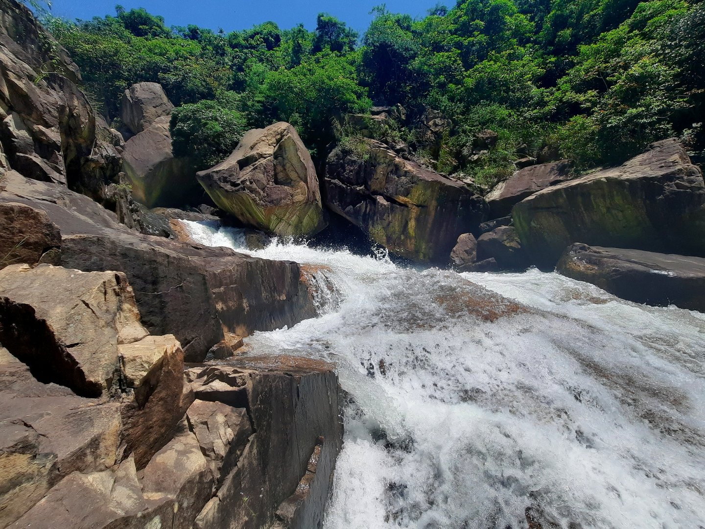
The name of "Sheung (Two) Shing Gorge" at the end of the Waterpipe Path came from its location – between the upper and lower Shing Mun Reservoirs. The open-air section of the Shing Mun Tunnel spans across the gorge, with a waterfall on the left. "Lower Shing Mun Waterfall" is the official name etched on a metal plate. The path joins the driveway of the east shore here. After crossing the bridge, go to the left to the bottom of the waterfall for a closer encounter, and to the right along the gorge to the heart-shaped pool at the bottom of the main dam. When the reservoir overflows in the rainy season, the flood water is discharged through the overflow outlet. In addition to the two roaring waterfalls in the gorge, another spectacular one from the overflow spillway on the right side of the main dam may also appear.
Sheung (Two) Shing Gorge
Lower Shing Mun Fall
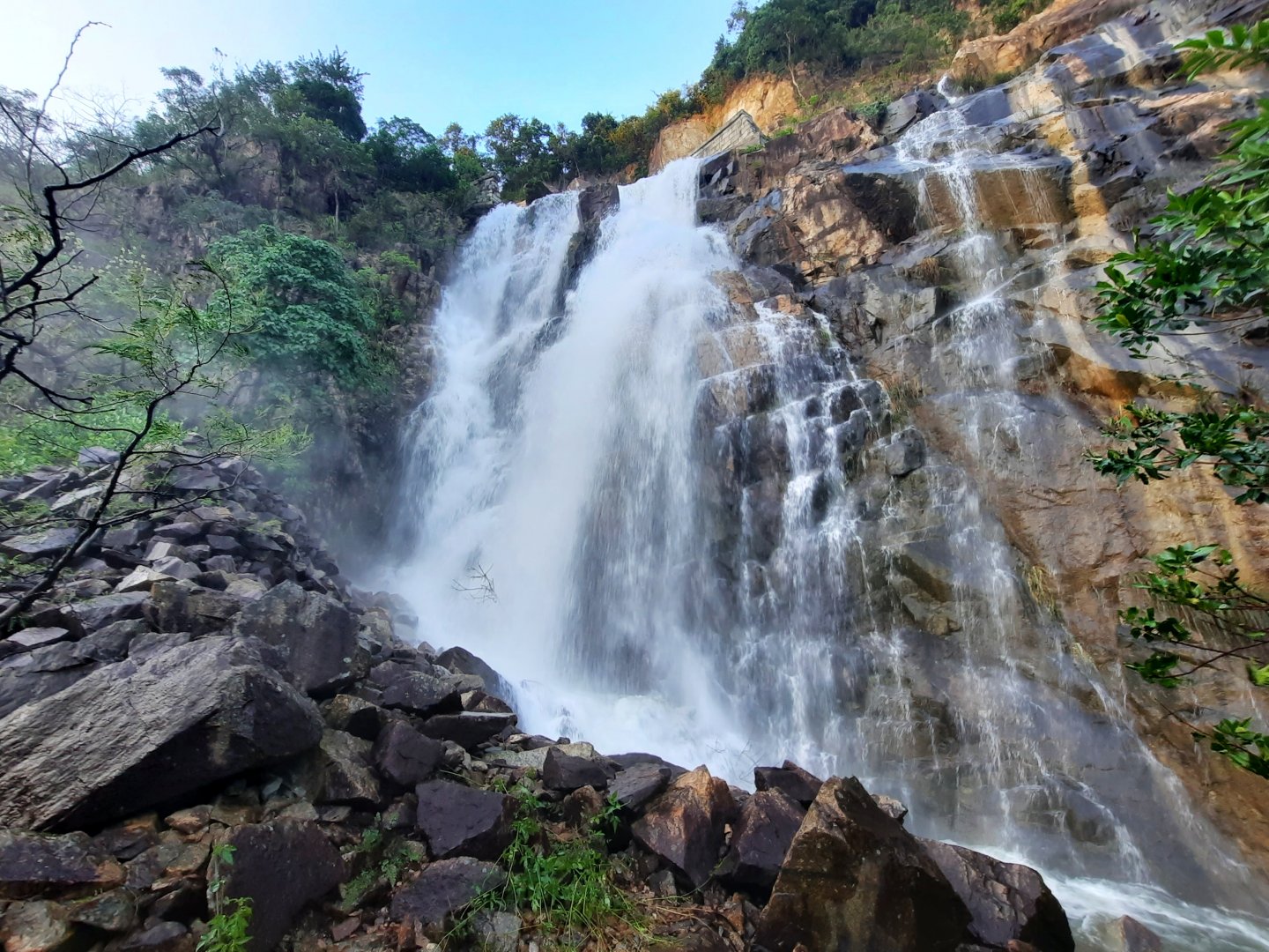
Waterfall from overflow spillway in rainy season
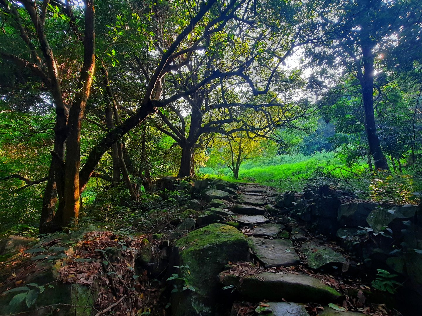
Three flights of steps at the center of the main dam takes you to the top, followed by a long walk around the reservoir on the section 7 of Wilson Trail (overlapped with the 5-km-long Jogging Trail plus section of Shing Mun Reservoir Walk) along the east bank of the reservoir, crossing the two major streams of Shing Mun Valley, Tai Shing, Tso Shing, and their tributaries on the way. This section is flat and easy, and offers the best chance to let go and relax completely. Being an amateur marathoner, instead of running laps at the sportsground or on hard surfaces in the streets, I often came here to run around the reservoir for training. There used to be 8 Hakka villages in the Shing Mun Valley, namely Shing Mun Lo Wai, Pak Shek Wo, Pei Tau To, Shek Tau Kin, Fu Yung Shan, Nam Fong To, Tai Pei Lek and Cheung Uk (also known as Ho Lek Bin, marked on the 1924 map as Ho Pui), collectively known as the "Eight Shing Mun Villages". The government relocated the eight villages between 1923 and 1936 due to the construction of the Shing Mun Reservoir. Most of the villages now only have remnants of stone walls and kerbs, and some are scattered on both sides of the jogging trail. Traces of Ho Pui (Cheung Uk) can be found around the gray bridge near the public toilets, while the lower reach of Tso Shing stream used to be the village of Shing Mun Lo Wai.

Former village at Shing Mun Valley, now home of the monkeys
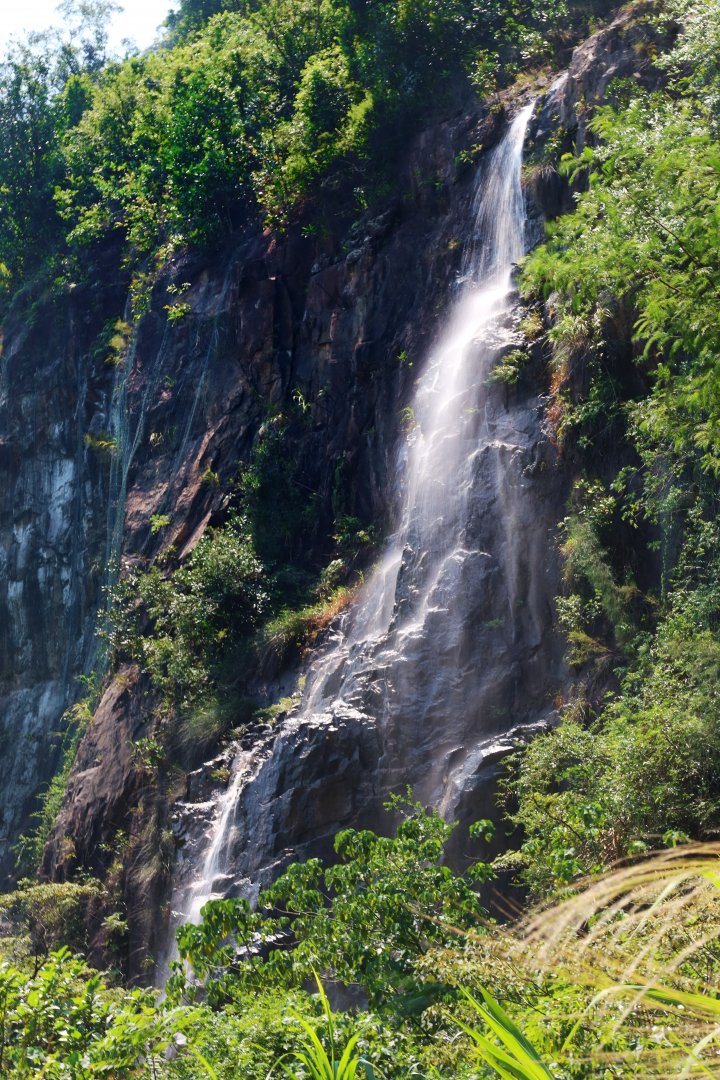
Turning right to the Lung Mun section of the Shing Mun Forest Track, at the end of the driveway is a mud trail. A boundary stone engraved with "Wu Yang Shan boundary" (that is, Fu Yung Shan, one of the eight villages) can be seen on the way. The rumbling sound from the Dragon Spring Gorge of Tai Shing stream indicates that we have reached the site of the former Wu Yang Shan Village. After walking nearly 14 km, it was time for lunch, a real pleasure for a short break by the stream.
Ruins of Wu Yang Shan Village
The first section of the route is a little bit long, but it is the easiest part, perfect for warming up. If you decide to stop here, it is also convenient to leave. Just go back to the Forest Track and head for the Pineapple Dam.
(To be continued)