The hiking season has finally begun, and most of the people are planning to travel more than ten kilometers a day. If you want to spend a single day walking 20 to 30 kilometers of the legendary "Level-Up Route" in the mountain world, and enjoy more scenic trails, what should you do? To this end, we interviewed Kelvin and Patty, two TrailWatch users who have completed many long-distance hiking routes, to share their experiences, from planning of routes; preparation of equipment, drinking water and food; to adapting ad hoc changes, and even how to deal with an accident. Let us learn how to accumulate daily walking miles, one step at a time, through the sharing of the two users.

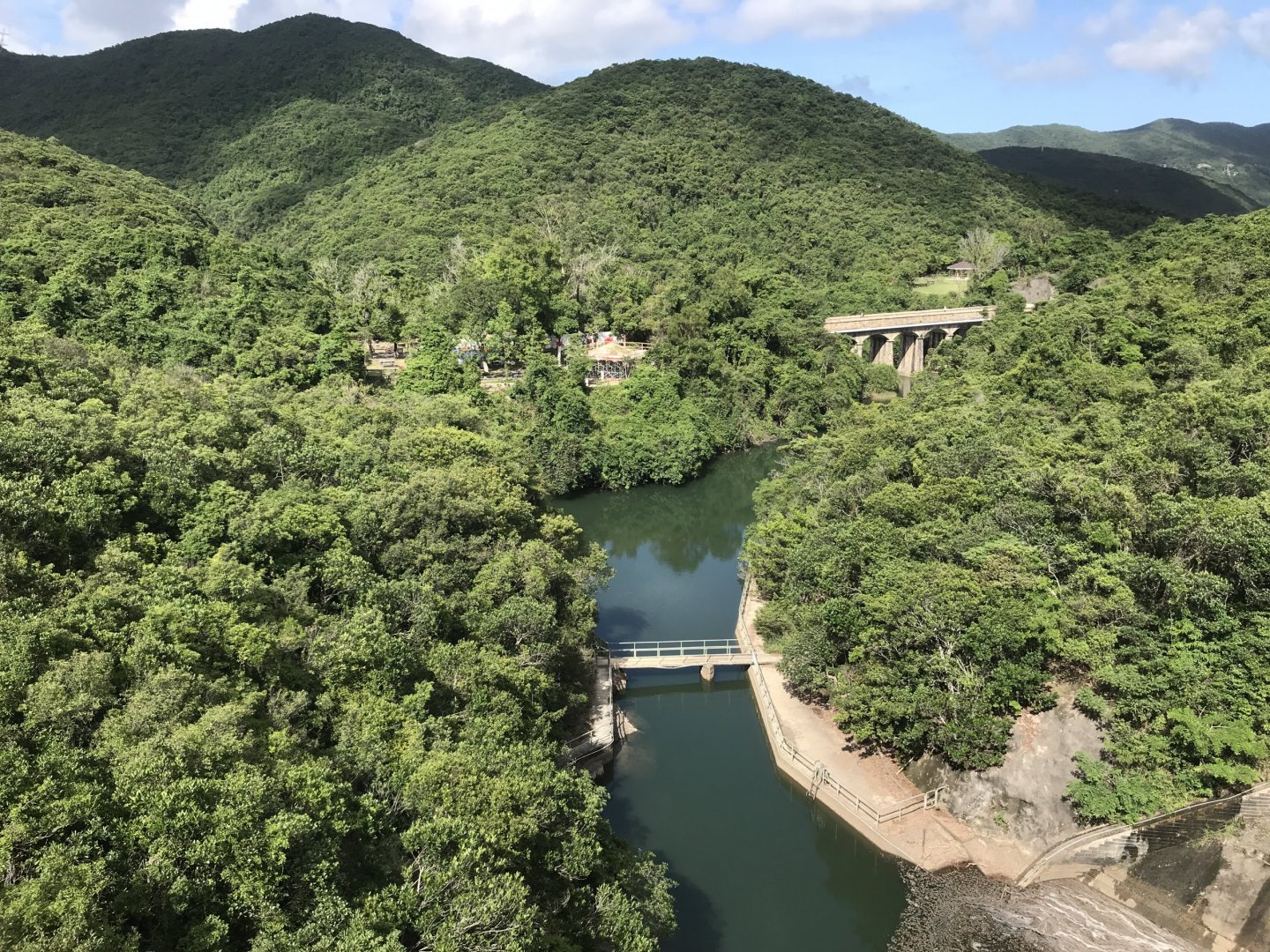
The view of Castle Peak Hinterland from the 30km-long route from Castle Peak to Yuen Tau Shan
Photo credit: Kelvin
Before Departure: Route Planning in Advance
Before meeting Kelvin, we were already impressed by looking at his TrailWatch records. Not only has he traveled a number of "Level Up Routes", such as "One Peak, Three Peninsulas, Four Beaches” ( Sharp Peak, Mai Fan Tsui, Tuen Tsui & Cheung Tsui, Tung Wan, Tai Wan, Ham Tin Wan & Sai Wan), which is 26 kilometers long, he also completed them fairly quickly. When we met, we realized that he is a young man in his early twenties but has many years of experience already in mountain hiking. Even though he is so familiar with the mountains, he is very diligent in his preparations. He searches for relevant road conditions on YouTube in advance, supplemented by maps and multiple mobile applications, and downloads an offline map the night before to identify roads and trails, checking if he needs to walk into off-track paths. He makes sure to know the road conditions off the top of his head. Kelvin, who lives in the Eastern District, will meet his friends to take the first bus and return before getting dark. It shows that aside from route selections, time management is also important in his planning.
Another interviewee Patty also has a lot of experience, but she has different preferences in long-distance routes. For example, she has walked all eight reservoirs on Hong Kong Island in one go, Tai Mo Shan to Wu Kai Sha, and even the eleven hilltops of Kowloon. These routes were all pre-planned in the TrailWatch APP by Patty before departure to ensure that she would not deviate from the planned routes. What the two users have in common is that they set off at 6 o'clock before sunrise, limiting themselves to complete the trip before sunset, in order to minimize unforeseen risks.
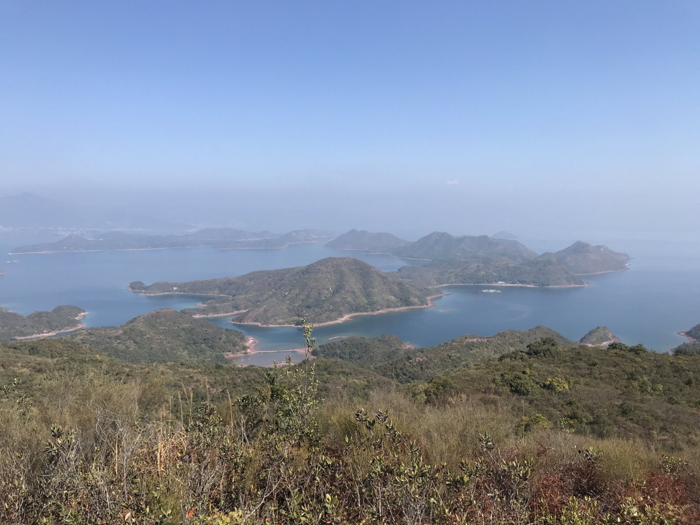
Tai Tam Intermediate Reservoir from the Eight Reservoirs route
Photo credit: Patty
Before Departure: Preparation of Equipment, Food and Water
When asked what Kelvin usually brings to the mountain, he chuckled and said that he only brought Decathlon's HKD 19 backpack, a 2L water bag, and two rice balls. He doesn’t care about expensive equipment and shoes that are worth several thousand dollars. And Patty shared her and her friend's past injuries when they were walking through the forest in the mountain. Fortunately, she brought basic first aid supplies and liquid plaster with her at that time, so that the situation did not deteriorate and the trip was successfully completed. Patty usually eats a small packet of ketchup collected from a fast food restaurant to quickly replenish.
Midway through the Trip: Routes Change
Although Kelvin and Patty are both veteran hikers, they both said in unison that if they can't get a friend to go with them, they will only take the main road, that is, the “official” mountain trail to avoid walking alone on some small paths. And if it rains, or the weather is not ideal, they will also prefer to change to a main route and not take any risks.
Midway through the Trip: Accidents
Patty also mentioned that she imagines falling off a cliff, hence she brings a personal alarm with her, hoping the loud noise can draw people’s attention and help to locate her during rescue. She even learned how to tie the "single-handed knot", and thought if she fell off the cliff and broke one of her arms, she could still be pulled up to the helicopter with another arm.
A challenging hike around the Plover Cove Reservoir, to visit the Devil’s Fist at Wong Chuk Kok Tsui
Photo credit: Patty
After the Trip: Consolidate Different Experience
Both Patty and Kelvin use TrailWatch to review their trips afterwards. “I tell my friends to use the birdie app all the time,” Patty beamed. After a long day of hiking, TrailWatch, which has both web and app applications, is their first choice to jot down their notes of the journey.
Trailwatch Team hopes that in this hiking season, everyone can set a small goal for personal breakthrough and try a long-distance route.