Text: Stephanie Wong
What will it look like in the future if we do not stop the countless reclamation projects now?
In our previous article, we discussed how the Hong Kong Island coastline has changed since 1842. Click here to read it again
At the time, Hong Kong needed to develop an economy and provide homes for the increasing population. Therefore, few people considered the impact of the reclamation projects. Starting in 1990, people became more aware of the environmental harm brought by the reclamation. They saw the irreversible damage caused and argued to protect the environment, resulting in the government passing "The Protection of the Harbour Ordinance" in 1996.
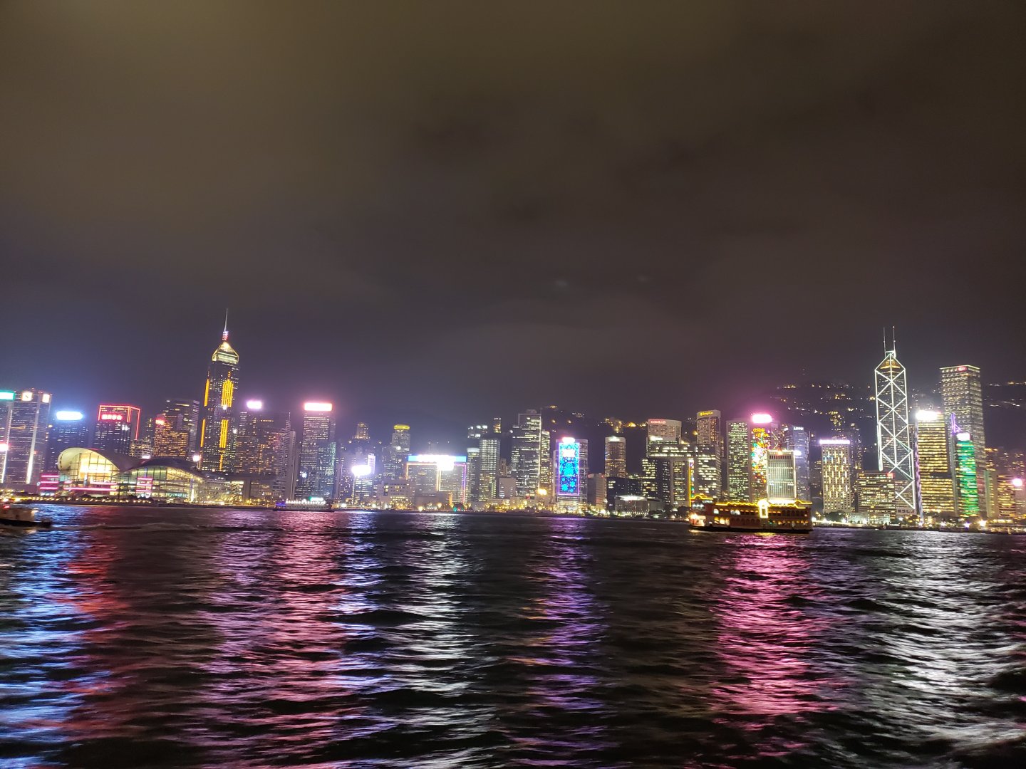
Night view of Victoria Harbour from Tsim Sha Tusi to Hong Kong Island (Image Credit: Stephanie Wong)
In 1990, we had Central and Wan Chai Reclamation to increase land supply for different purposes, including infrastructure. 30 years later, we have reclamation projects such as Lantau Tomorrow Vision, put forth with an aim to increase the land supply and solve the housing problem. Many environmental groups and activists believe this reclamation project does not solve the housing problem, but adversely impacts the city, including suffocating our already-vulnerable marine life. Why are these environmental groups opposing this project? Instead of reclaiming land, why not redevelop so-called brownfield sites in the New Territories?1 Liber Research Community, a local research group, has research in 2018 to study the development potential of developing the brownfield sites in New Territories. Can this be an option that replaces reclamation to increase the land supply?
Some people joke that if reclamation along the Hong Kong harbourfront continues, one day we would be able to walk to Kowloon from Hong Kong Island. Can you imagine this? Today you can walk the Hong Kong Island Coastal Trail (#HKICT), but if Hong Kong Island and Kowloon were to be connected, there would no longer be a unique island coastal route that blends urban harbourside, residential neighborhoods, beachside views and country park natural trails all in one.
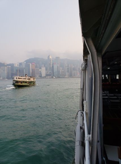
Image Credit: Stephanie Wong
The view of Victoria Harbour will also disappear. A major shipping channel would be lost and boats would have to go around the south side of Hong Kong Island. Star Ferry, a historical and popular commuter system in Hong Kong has seen its rides shorten over the years due to the reclamation. Back in 1880, the route of the ferry ride from Pedder Street to Tsim Sha Tsui took 40 – 60 minutes. Now, the shoreline has changed so much that it only takes 9 minutes from Man Kwong Street where the Star Ferry pier is now located to Tsim Sha Tsui. A connected and narrower harbourfront would render the Star Ferry obsolete, risking it closing forever, and another legacy and piece of our history would be lost if the reclamation continues.
The impact of reclamation is much more than lost views. How will it affect our lives?
Environmental issue – both marine species and plants are affected
Reclamation directly affects our waters. The construction itself not only destroys the habitat and reduces the biodiversity of marine animals, the construction waste harms the water quality, which further destroys the coastal habitats.

Image Credit: Wikipedia
In the last article, we shared that Cyberport is built from reclamation around Telegraph Bay. Did you know that this was where the Bauhinia x blakeana was first discovered in 1880? The French Catholic Missionary who found the species propagated it to Béthanie at Pok Fu Lam. We can now see the Bauhinia x blakeana in some parks around Hong Kong; sadly, due to the roads and buildings built in this area, we can no longer find this species where it was originally discovered.
Climate Change – worsening living environment
Climate change is a hot topic worldwide, and people are trying to understand how it affects the world in the future. Hong Kong is forecast to experience a significant increase in extreme weather frequency and intensity due to climate change. The sea level will continue to rise over the next few decades. How is this related to the impact brought on by the reclamation?
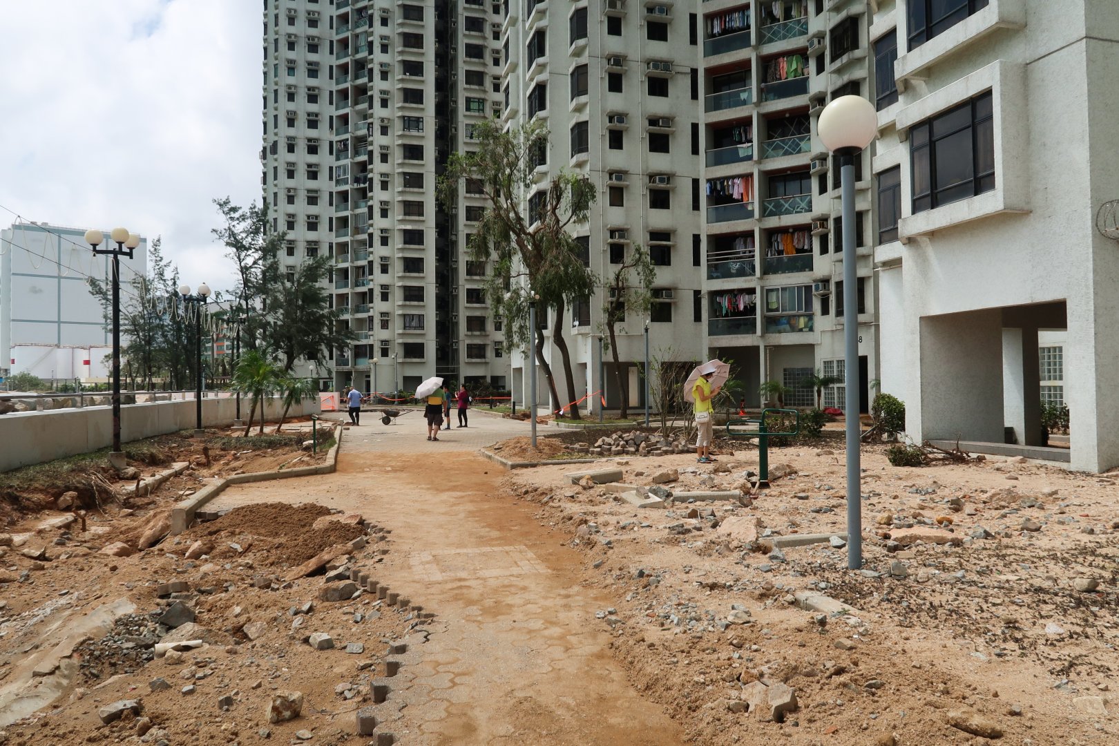
Scene of Heng Fa Chuen after Typhoon Mangkhut in 2018 (Image Credit: Wikipedia)
The level of the reclaimed land was 3.7 metres above the principal datum in the 1980s. Yet, the sea level keeps rising year by year and the level of land remains unchanged, making it susceptible to flooding during extreme weather conditions, and increasing the danger of living on reclaimed land. A case in point is Heng Fa Chuen, which was reclaimed from Pak Sha Wan, and coupled with its geographical location, leaves it extremely vulnerable during typhoons.
Lost heritage and history
The reclamation not only affected the environment; locations that are full of historical meaning have also gone. The most well-known case is Queen's Pier, which closed due to the Central and Wan Chai Reclamation. It was the traditional landing place of all Hong Kong's governors, and ceremonial landing area for the British Royal Family visiting Hong Kong, including Queen Elizabeth II and Prince and Princess of Wales.
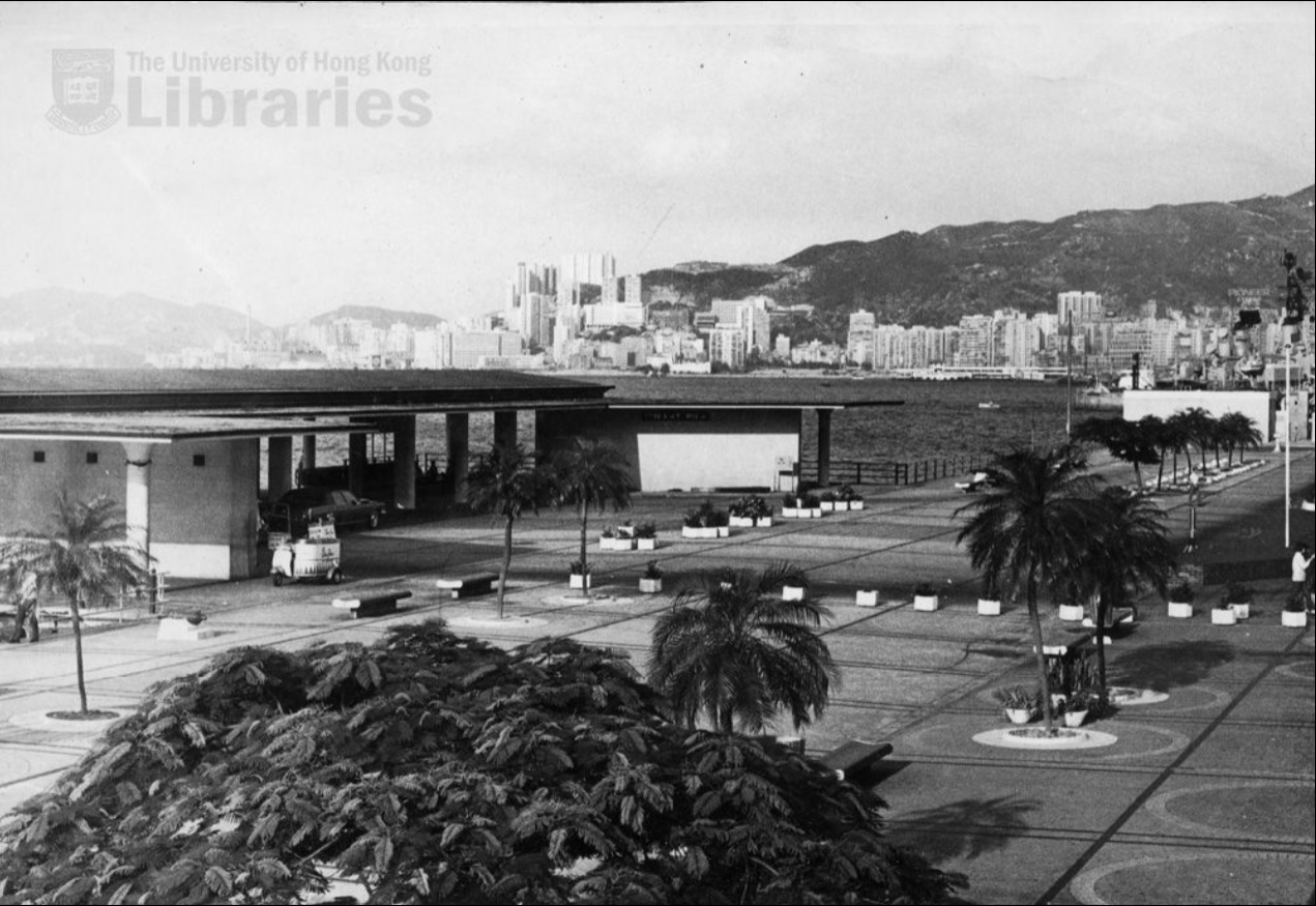
Queen's Pier on the left was opened in 1954 and was demolished in 2008.
Photo credit: The University of Hong Kong Libraries, Hong Kong Image Database (https://digitalrepository.lib.hku.hk/hkimage/)
Queen's Pier, Hong Kong City Hall and Edinburgh Place showcase the architectural style of Hong Kong in 1950, and together formed a site that provided an open space for the public to go to. The demolishing of Queen's Pier ruined this history and the architectural meaning of this area to provide for the public an area for respite, take a rest or to organize public events.
As reclamation continues, other locations are facing the possibility of losing their meaning.
The Jardine Noonday Gun in Causeway Bay was used to fire a gun salute to welcome a Jardine tai-pan's arrival by the sea a long time ago. What if the sea in this area is completely reclaimed and the noonday gun is no longer on the harbourfront? Its historical significance would be lost on us, and our next generation would find it difficult to picture how it was fired to indicate the arrival of important people by boat.
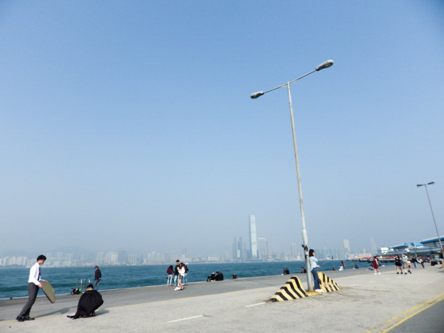
People taking photos and enjoy the harbour view at The Western District Cargo Working Area (Image Credit: Stephanie Wong)
The Western District Cargo Working Area, also known as Instagram Pier, is a hot spot for people to congregate for recreation, attracting amateur fisherman, families, runners, photographers and the public because of its clear view of Victoria Harbour and the sky mirror that appears after the rain. However, if the Lantau Tomorrow Vision goes according to its plan, the public may no longer enjoy the harbour landscape from this area anymore, as it will be used to build a new tunnel that would connect Kennedy Town to East Lantau. If this reclamation goes ahead, will this area still be "Instagrammable" enough for photo shoots? Will it still be a pleasant public space for friends, residents and neighbors to go for walks, play and have a moment to unwind and enjoy?
10 years later
Reclamation projects have come one after another; if we continue, what will become of the Hong Kong Island Coastal Trail in ten years time? The harbourfront that you see nowadays may be reclaimed as a residential area one day. Is it worth reclaiming the land from the sea at the expense of losing our treasured assets?
You can get to know more about the coastline by finishing the Hong Kong Island Coastal Trail (#HKICT). Besides enjoying the beautiful landscape, try to feel and sense the land beneath your feet. Imagine how it will look like if these areas continue to be reclaimed. What's lost cannot be undone. Take a moment to share your memories and records of this coastline by taking photos, sharing them on social media, and spreading the message to treasure the coastline of Hong Kong.
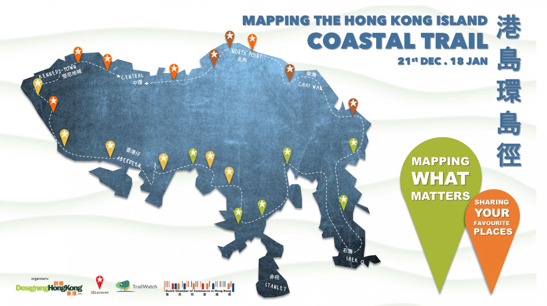
Mapping The Hong Kong Island Coastal Trail
2020.12.21 – 2021.01.18
Registration: https://dutchchamhk.glueup.com/event/30453/register/
More detail: https://www.coastaltrail.hk