Text: Stephanie Wong
The coastline of Hong Kong has changed a lot between 1842 till now, especially for Hong Kong Island. Of course, if you were to walk the coastline back then, you wouldn’t see the high-rises and the buses and cars that pass along daily by the harbourfront today.
You may not notice it, but nowadays when you walk the Hong Kong Island coastline, the land that you walk on — especially around areas to the north side of the island along Victoria Harbour — are reclaimed land, from Jervois Street to Shun Tak Centre at Sheung Wan and from Victoria Park to the Cross Harbour Tunnel at Causeway Bay.
Why and how did reclamation begin? The main reason was that Hong Kong needed more land for economic development. Not only did it create job opportunities at the time, but most of the reclaimed land later became the business area of Hong Kong.
Let’s walk through the Hong Kong Island coastline and see what the city looks like before and after the reclamation.
Before the war (1842 – 1920)
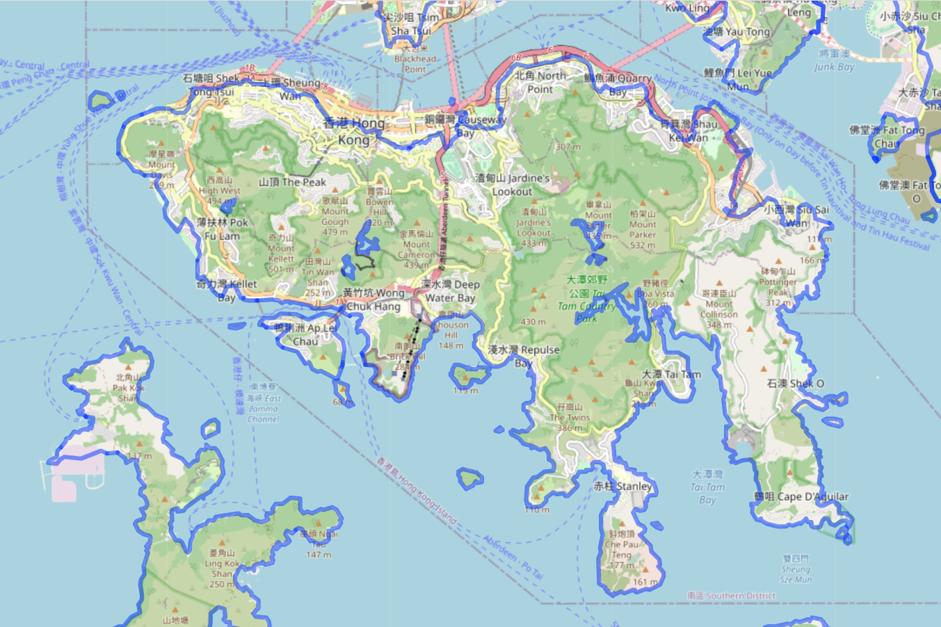
The blue line shows the coastline of Hong Kong Island in 1845 (Image Credit: Hong Kong Maps)
An unplanned first reclamation?
The first reclamation project happened in 1842 in Victoria City1, to handle industrial waste. However, this project was not planned! At that time, Hollywood Road and Queen’s Road were under construction, resulting in the production of large quantities of sand and gravel; instead of storing it elsewhere, the then-government decided to pour it into Victoria Harbour and expand the area of Victoria City. Consequently, the coastline of Wan Chai was also extended to Praya East (now Johnston Road).

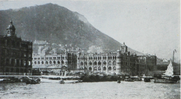
View of Victoria Harbour in 1846 – Building with arched porte-cochere and rectangular upper window located further down was old Hong Kong Club in Wyndham Street; Pier on the right was the Pedder's Wharf which now became Gloucester Tower
Photo credit: The University of Hong Kong Libraries 香港大學圖書館, Hong Kong Image Database (https://digitalrepository.lib.hku.hk/hkimage/)
The second reclamation started with a fire accident
Even the second project was not planned at all. This reclamation started because of a fire accident in December 1851, which destroyed over 400 houses along Queen’s Road. The then-Governor suggested to use the leftover debris to reclaim land, while increasing land supply. The Bonham Strand Reclamation Project was then officially started in 1852 to expand the Sheung Wan area and provide space to build the facilities for the government department. The area reclaimed for Phase 1 was Bonham Strand, Jervois Street and Morrison Street, while Phase 2 started in 1868 at Bonham Strand West.
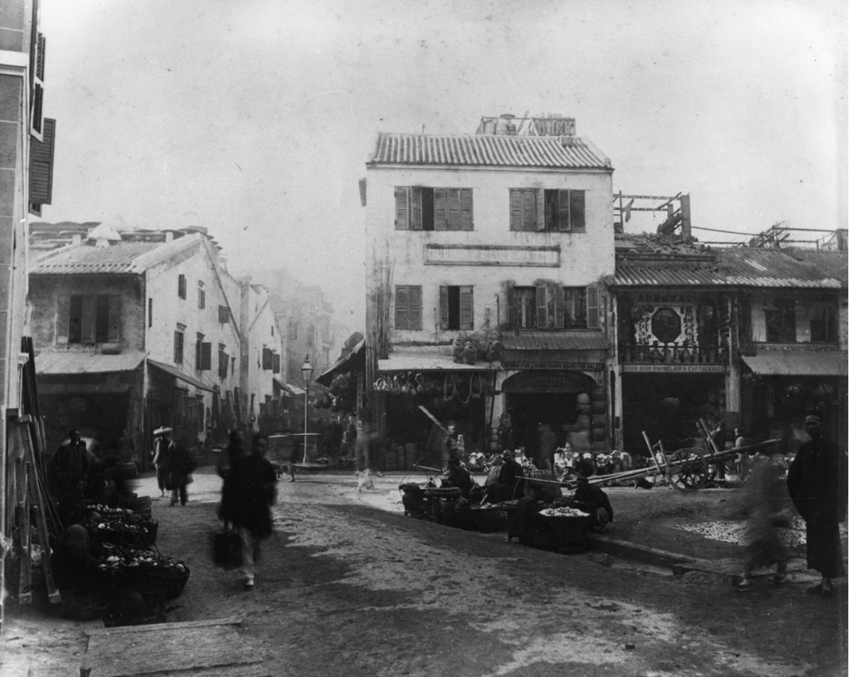
Morrison Street in 1885
Photo credit: The University of Hong Kong Libraries香港大學圖書館, Hong Kong Image Database (https://digitalrepository.lib.hku.hk/hkimage/)
East Point, the Northern Shore
You may have heard of East Point Centre, a shopping centre and commercial building in Causeway Bay, but did you know this area was a cape before it was reclaimed? “East Point'' in Chinese means northern shore and the area that was reclaimed starting in 1859 is the area where Sogo, World Trade Center and Windsor House now stands. In 1864, in order to build an urban and business area, there was a larger scale of land reclamation at Causeway Bay.
A reclamation project that was delayed by 30 years
The last reclamation project launched before World War II was the Bowring Reclamation Project, initiated by Governor John Bowring in 1850. The project aimed to construct a 4-mile-long waterfront promenade below the Government Hill from the Central waterfront to Causeway Bay. However, due to the ownership of the harbourfront, the project was opposed by many businessmen. Instead, the government started the Praya Reclamation Scheme from Bonham Strand to Kennedy Town. This reclaimed land was called Praya and changed to Des Voeux Road West later.
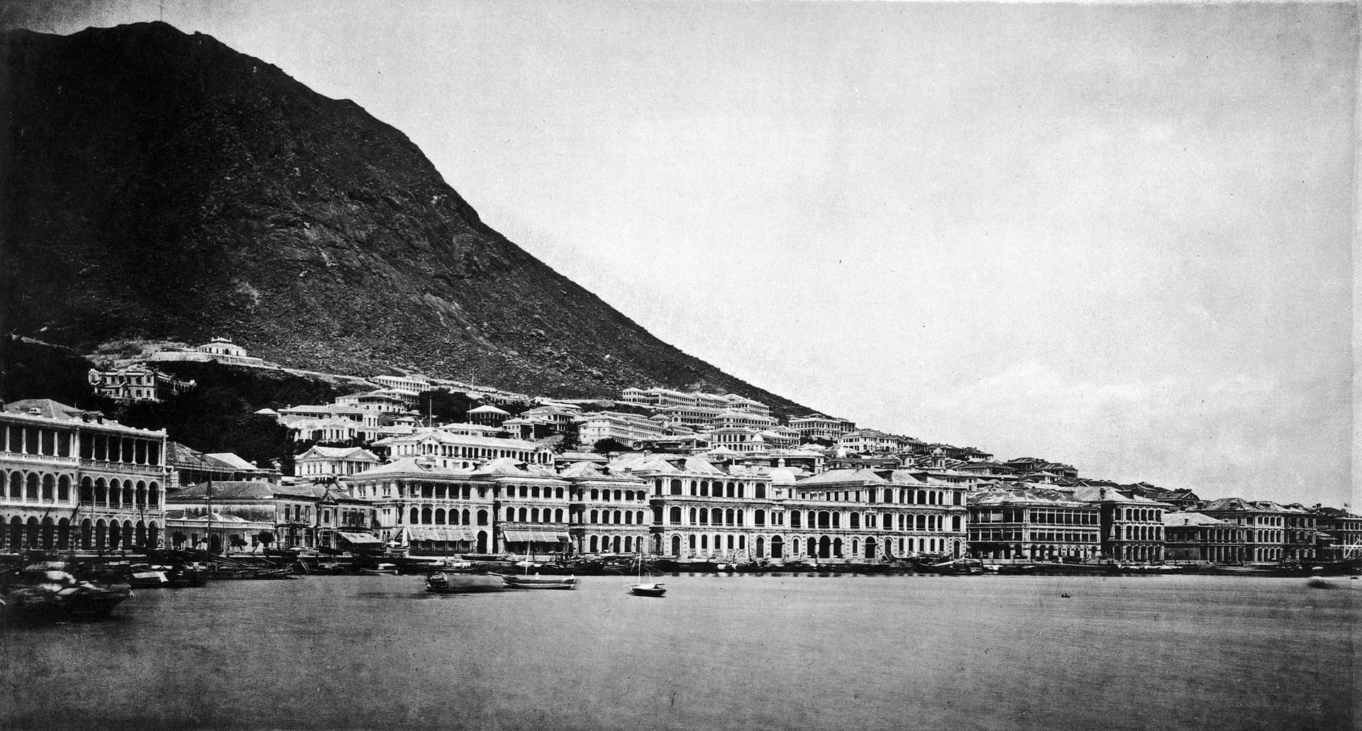
The Praya in 1870 (Image Credit: Wikipedia)
The Bowring Reclamation Project was delayed for 30 years and resumed in 1887. It was the biggest reclamation project at that time, spanning from Belcher's Street in Sai Wan to Queensway in Admiralty, including some area from Des Voeux Road Central to Connaught Road Central. Subsequently, many buildings with colonial architectural styles were built on this reclaimed land, such as Prince's Building, the General Post Office, Hong Kong Club, The High Court and Statue Square etc. Since then, many of these buildings have been redeveloped, including Prince’s Building and Hong Kong Club.
Left to right: Hong Kong Club, Prince's Building and Queen’s Building
Photo credit: The University of Hong Kong Libraries 香港大學圖書館, Hong Kong Image Database (https://digitalrepository.lib.hku.hk/hkimage/)
In 1883, the government also reclaimed land from the sea around the Causeway Bay Typhoon Shelter, which is now called Causeway Road.
After the war (1950 – Present)
Reclamation Project in 3 of the “bays” (1950 – 1965): Causeway Bay, Chai Wan and Siu Sai Wan
After the Second World War, reclamation was first continued in the New Territories to build residential areas. During this period, the government also began more reclamation on Hong Kong Island. In 1950, the first bay that was reclaimed was Causeway Bay. The government filled and levelled up the Causeway Bay Typhoon Shelter, and it became Victoria Park.
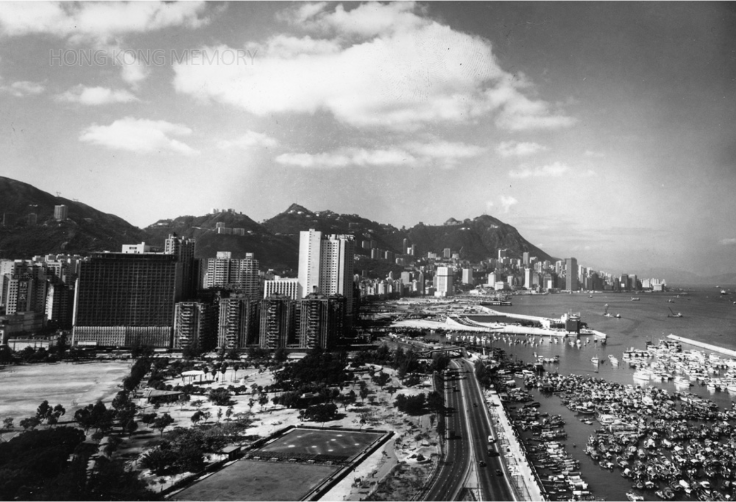
Victoria Park and Harborfront of Causeway Bay in the 1970s
Photo credit: The University of Hong Kong Libraries 香港大學圖書館, Hong Kong Image Database (https://digitalrepository.lib.hku.hk/hkimage/)
“Wan (灣)” in Chinese means bay, hence, from the name you can tell Chai Wan and Siu Sai Wan were a bay in the past. After the reclamation, the Chai Wan harbourfront became the public cargo working area. Siu Sai Wan was developed into a residential area to absorb the increasing population at that time.
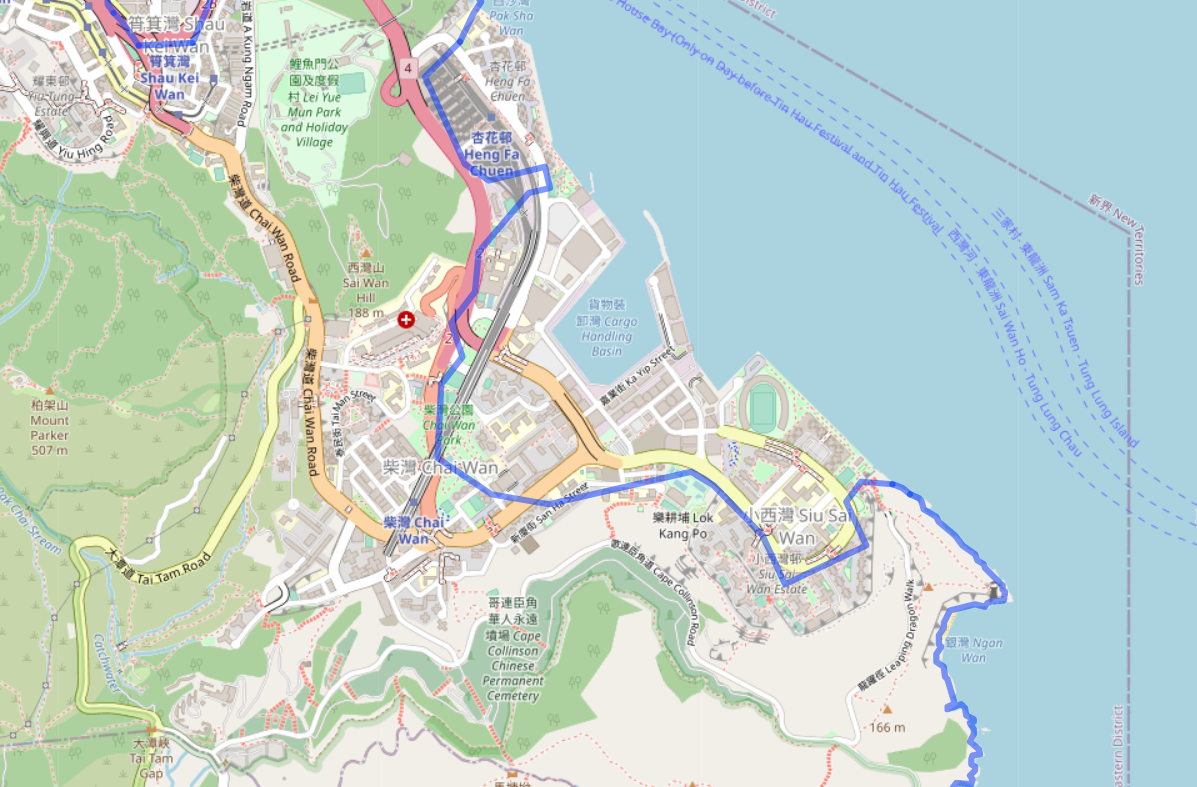
The blue line indicated the coastline of Chai Wan and Siu Sai Wan in 1924 (Image Credit: Hong Kong Maps)
The names that have disappeared since reclamation
There was an island called Kellett Island, also known as Lantern island, and was one of the very few islands in the Victoria Harbour. Due to the construction of the Cross Harbour Tunnel, this island was connected to Hong Kong Island at Causeway Bay following land reclamation. The southern entrance of the Cross Harbour Tunnel is located on what was once Kellett Island.
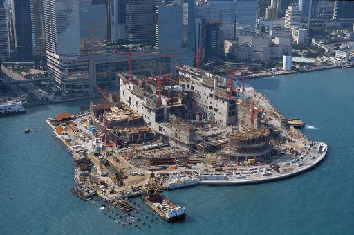
Reclamation on Hong Kong Island was expanded beyond Victoria Harbour. There were areas reclaimed in the Southern district, such as Aberdeen and Ap Lei Chau. Additionally, Telegraph Bay was reclaimed in 1980 and not occupied until 2000. In order to develop the technology industry in Hong Kong, this reclaimed land was renamed Cyberport and used as a digital technology community. Development in the Southern district eventually declined, and there were no more reclamation after 1989.
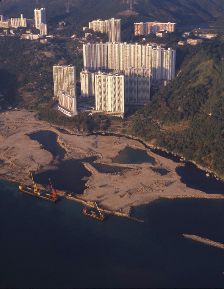
Construction of Cyberport in 1970
Photo credit: The University of Hong Kong Libraries 香港大學圖書館, Hong Kong Image Database (https://digitalrepository.lib.hku.hk/hkimage/)
More projects, but faced delays and opposition (1990 – Present)
By 1990, the coastline of Hong Kong Island has changed significantly since the 19th century, but the reclamation did not stop. Central and Wan Chai Reclamation began in 1993 with the aim to provide land for the Central – Wan Chai Bypass and the railway. It also planned to create a harbourfront promenade with green and public space.
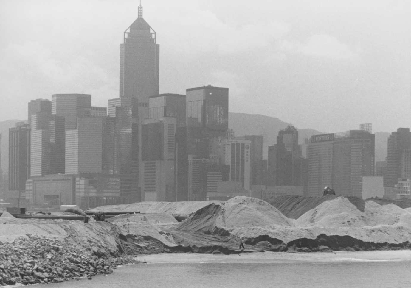
Construction of Central Reclamation Project in 1995
Photo credit: The University of Hong Kong Libraries 香港大學圖書館, Hong Kong Image Database (https://digitalrepository.lib.hku.hk/hkimage/)
Phase 1 was complete in 1995 – 1996, where IFC, Hong Kong Airline Express, Central Ferry Piers and New Wing of the Hong Kong Convention and Exhibition Centre now stands.
Construction of Hong Kong Convention and Exhibition Centre in 1995 (Image Credit: Dragages Hong Kong Limited)
However, reclamation projects on this large scale brings huge damage to Victoria Harbour. Consequently, some people raised awareness for the environmental concerns brought about by this reclamation. The Protection of the Harbour Ordinance was passed in 1997 and successfully postponed Phase 2 of the Central and Wan Chai Reclamation until 2004.
Image Credit: Stephanie Wong
In 2012, the government announced the “Enhancing Land Supply Strategy – Reclamation outside Victoria Harbour and Rock Cavern Development,” which selected 5 areas in Victoria Harbour to increase the land supply of Hong Kong. The coastline of Hong Kong Island will further expand in the future.
Image Credit: “Being Hong Kong” (Collection provided by John Wu)
These reclamation projects increased the land supply of Hong Kong and brought economical benefits to the city. However, during the construction, it caused irreversible harm to the environment. If we continue to reclaim land around the harbourfront, the beautiful views that we now enjoy as you walk along the coast and promenade will disappear. If we only stand by and watch, how will Hong Kong's coastline be different in the future?
In the next article we will explore more the impact of these reclamation projects.
1Victoria City is the de facto capital of Hong Kong during the British Colonial period and most of it is present day Central