Text & Photos: Daniel-C
Read the previous chapter: The Waterfall Selu – 27-km Discovery Journey of Streams and Waterfalls (I)
(2) Descending Sze Fong Shan to Ng Tung
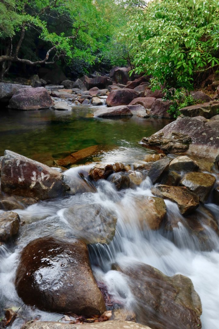
Dragon Spring Gorge, Tai Shing Stream
The Dragon Spring Gorge is the starting point of the popular steam trekking section of Tai Shing Stream, with an exit point near the huge boulder named "Fat Lo Mak". Since our route goes by trail, we head back to the "Tiger Path" intersection – the rugged and steep but clear trail also leads to "Fat Lo Mak". Watch out for the spectacular "One Dragon" waterfall on the way, a tributary of Tai Shing Stream called Wong Mo Stream.
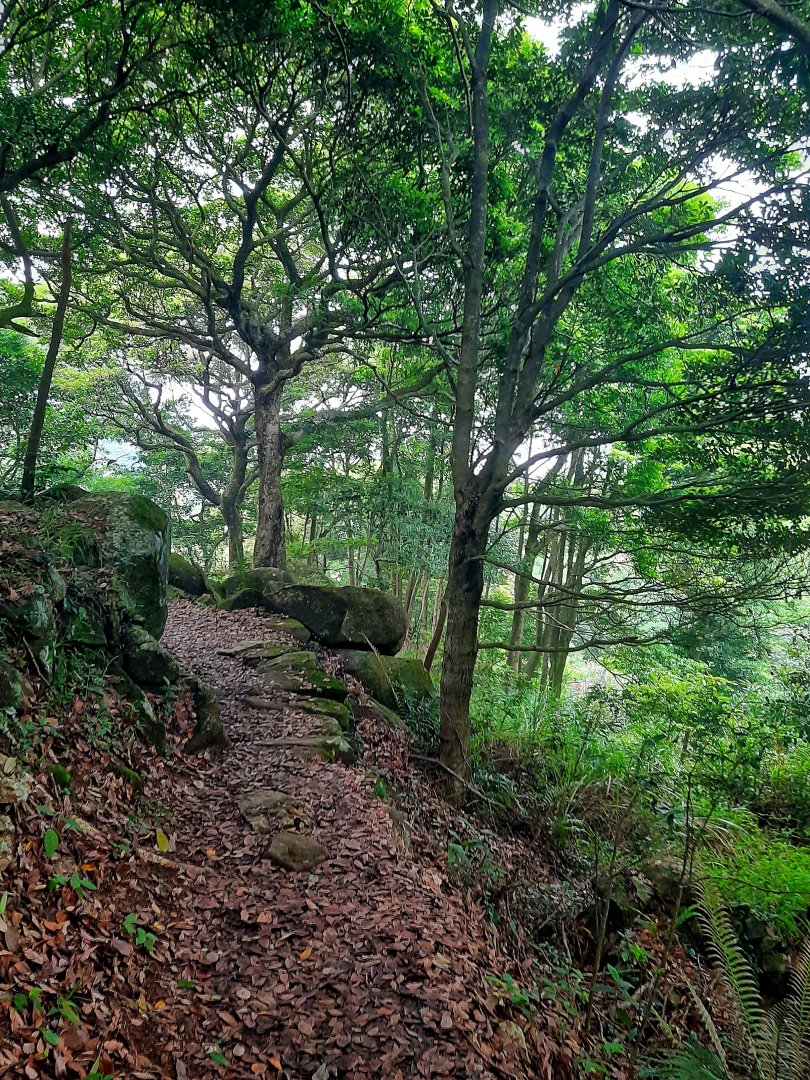
After crossing the stream at "Fat Lo Mak", a large patch of bamboo soon comes into sight. Under the bamboo grove were the remains of stone walls and kerbs, the former site of the Nam Fong To Village. The village was marked on the Map of Xin'an County as early as 1866. Look carefully for the entrance to the overgrown trail on the left. Vaguely recognizable, this ancient trail on the southern ridge of the Sze Fong Shan leads to Sze Fong Shan Pass. The trail sometimes disappears under the overgrown vegetation, and sometimes it is like walking on narrow and steep scree, but it is still possible to see the neatly laid boulders where the slope is gentle. Walking on this section, certain experience with overgrown paths is required, especially when entering an area filled with ruins and broken walls – it looks like there are traces of a trail in all directions, and it is easy to get lost. Walking on the ridge, the gurgling sound of Tai Shing Stream and its tributary at the bottom of the valley can be clearly heard. The weather radar station on the top of Tai Mo Shan plays hide and seek among the clouds and mist, and Sze Fong Shan is also in sight. Looking around at Sze Fong Pavilion, remnants of the tea plantation on the hillside can still be seen.
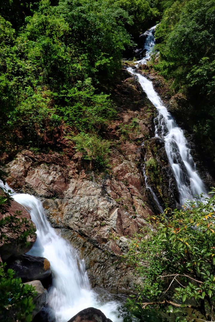
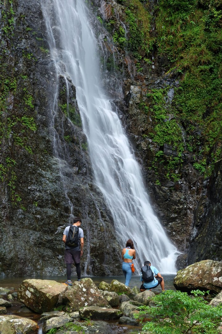
The "One Dragon" waterfall of Wong Mo Stream
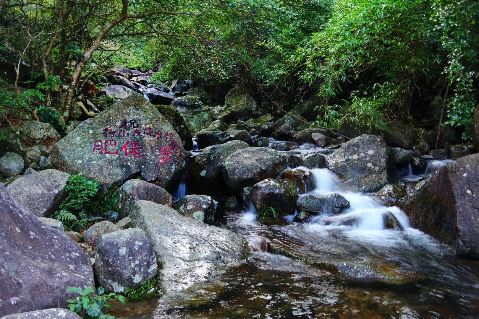
Fat Lo Mak
Heading north along the downhill trail, the route runs across the upper reach of Ng Tung Stream and then descends into the ravine. Turn right at the Kai Kung Tau junction to the Ng Tung Chai waterfalls trail, and enjoy the breathtaking waterfalls along the way: Maiden Falls, Scatter Fall, Wild Banana Fall, Long Fall (Main Fall), Rainbow Fall, HorseTail Fall (Middle Fall), Bottom Fall, and finally the Kai Kung Hang Waterfall in front of Man Tak Yuen Taoist temple. Walking down the driveway at Ng Tung Chai Village, we soon reach Lam Kam Road.
Ng Tung Ravine, Northern slope of Sze Fong Shan
Long Fall, Ng Tung Stream
The 8.6-km-long section starts with the rugged Tiger Path, followed by the desolate ancient trail, and then down a slippery steep waterfall trail, certainly a lot more demanding than the first section. The total distance covered so far already exceeds that of a half-marathon, and if you decide to go on, the next target is the Tai To Yan Range.
(3) Over the To Yan Range
The gurgling water in the Lam Tsuen River comes from the mountains on both sides of the Lam Tsuen Valley. Originating from Sze Fong Shan on the east side, Ng Tung Stream is the main source of the river, with tributaries coming from Kwun Yam Shan. At the same time, it is also fed on the west side by the streams from the Tai To Yan Range, such as Pak Ngau Shek Stream, To Yan South Stream, Upper Lam Tsuen Stream and Wo Tong Pui Stream. After descending to Lam Kam Road from Ng Tung Village, the nearest trailheads for ascending To Yan Range should be those at Pak Ngau Shek, with trails on the ridges at both sides of Pak Ngau Shek ravine. However, those trails have long vanished or became unclear under the overgrown vegetation. Instead we head south along the Lam Kam Road for the trailhead of Tai To Yan Trail, a clearly marked trail in good conditions, with loads of ups and downs. Starting with a steep climb to Ma Tsai Tong (Kow Yu Tong), it goes straight up 300 meters. You may continue on the 10-km trail that leads all the way to Fanling, but then the total length of the route would eventually exceed 32 km. Therefore, after passing through Au Mun and summiting peak 411, look for the trail descending along the left ridge of Wang Toi Shan Stream.
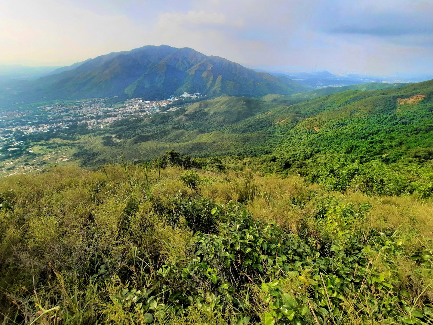
Pat Heung and Kai Kung Leng, viewed from the Left Ridge of Wang Toi Shan Stream
Known for its towering dark waterfall wall in the middle reaches, Wang Toi Shan Stream (also known as Hung Fa Stream) has its source at Au Mun. The trail on the left ridge of the ravine is actually a "trail without trace" – seasoned hikers will walk freely down the gentle grassy slope along the ridge based on their experience. But to the average hikers, the vaguely visible trail exists only in the dry season, but disappears under the lush vegetation in the rainy season. Do think twice before deciding to take this route.
The original route turns right into the bushes at a height of about 300 meters above sea level, and then stays in the direction towards the Feng Shui burial site named "General's Reception of Seal". On a recent visit, I lost track of the trail at the edge of the bushes, so I continued walking on the grassy slope. After reaching the tomb next to the stream, a tomb sweeping trail led all the way to the warehouse driveway, and the 27-km route ended at the nearby Walled Village of Wing Ning Lei at Wang Toi Shan. As the final section of the route faces due west, there is a good chance to see the beautiful sunset of Pat Heung, but with declining physical strength and bad trail conditions, it is certainly not a good idea to stay on the mountain when night falls, not to mention the danger of facing the rampage of village dogs at night. Do keep track of time.
The 27-km journey takes about 11 hours, and it is necessary to start as early as possible to ensure that it ends before 17:30. I always feel that the route is more enjoyable if it is split into two day trips. In addition to visiting streams and waterfalls, the route actually includes the exploration of Hakka villages past and present. The traditional semi-circular Feng Shui Pond still exists in front of the Entrance Gate at Wing Ling Lei, gathering waters from the surrounding mountains. A perfect ending point for a stream and waterfall themed route.
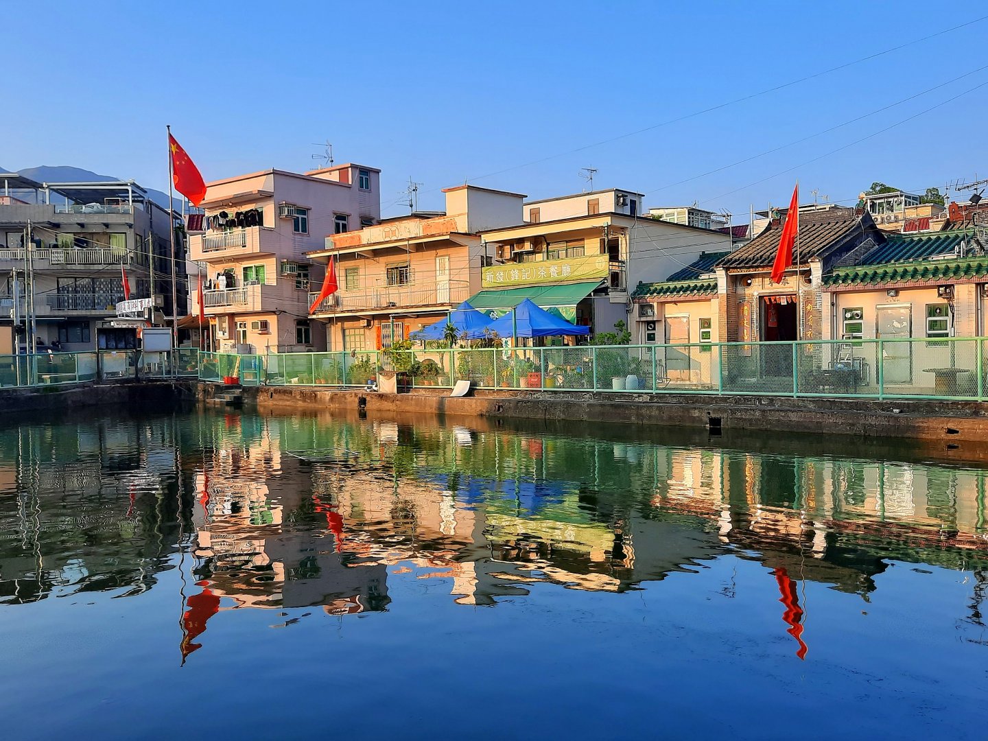
The traditional semi-circular Feng Shui Pond at Wing Ling Lei
When picking a name for the route, "Taki no Selu" (The narrow road to the waterfalls) came first to mind. Obviously, it is a reference to the "Oku no Hosomichi" (The Narrow Road to the Deep North) by the Japanese haiku master Matsuo Basho, a collection of haiku poems about the experiences and thoughts of his travels to Oshu and Hokuriku. "Taki" is the Japanese kanji for "waterfall", a combination of the characters for "water" and "dragon". In comparison with the Chinese character for Waterfall, which derived from the characters for "water" and "violence", the Japanese kanji can better express the intermittent flow of waterfalls due to the changing seasons, rather than emphasizing only on "violence". That is the reason I keep the Japanese kanji "Taki" in the Chinese version of the name. And the word "Selu"? It is the term for "small path" in Hakka dialect, as in "Raknus Selu" of Taiwan.